सभी
← Back to Squawk list


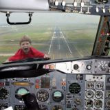


Ill-fated UPS jet was on autopilot seconds before crash
"The autopilot was engaged until the last second of recorded data," said Robert Sumwalt, a senior official with the National Transportation Safety Board. He said information retrieved by investigators from the flight data recorder aboard the United Parcel Service jet showed that its auto throttle also was engaged until moments before the fiery crash. (news.yahoo.com) और अधिक...Sort type: [Top] [Newest]
As an additional comment, any terrain or excessive sink warning at night should trigger a mandatory go around.
somebody should have been inside that cockpit, even if you compute a simple three to one glideslope in your head as a check: 4 miles out = 1200AGL, 3 miles out = 900AGL etc. That will at least put you in the ballpark.
George has a time and place to fly the airplane. That would be at cruise. Checklist was likely ignored. Hands on brother after IAF. Pilot in command.
maybe they forgot to reset the altimater
Local altimeter setting was between 29.97 and 29.99 per several METARs covering the period.
Difference from 29.92 to 29.99 is only 70 feet, and in this case on the high side (above indicated altitude) anyways.
Difference from 29.92 to 29.99 is only 70 feet, and in this case on the high side (above indicated altitude) anyways.
If it was 70ft low, it could be critical given the local topography. But 70 ft high should have saved them the sudden stop.
Tree height !
I have searched, although briefly for anything resembling a topographical map to no avail. Two dimensional maps from Google and even approach plates just don't get the job done. and stories of landing airplanes half the size of this one don't compare in my mind. The best information I found was in Ivan Warrington's post a few posts above this one. Not much to go on leaving only conjecture and suspicion. From all the information we have, we can't tell of the A300 collided with a tree, a telephone pole, or a blade of grass. The talk of a "rapid decent" but don't define it. Very frustrating. I'll bet the investigators don't speak nor write in those terms to anyone but the public. Where did they begin their final approach, what was the altitude, what was the rate of decent. Pretty straight forward stuff that will still leave questions but less of them.
"Tree height"? When you research the TERPS (Terminal Instrument Procedures Standards) criteria, although the terminology is extremely complicated and difficult to wade through, as a rule-of-thumb minimum I read 300 feet over any obstacles that encroach into the Approach path...depending on proximity to the centerline. (Generalizing).
The KBHM LOC Runway 18:
http://flightaware.com/resources/airport/BHM/IAP/LOC+RWY+18/pdf
Here is a PDF link with legends for de-coding the symbology:
http://aeronav.faa.gov/content/aeronav/online/pdf_files/IAP_Symbols.pdf
(You may hear about "Jepps" Charts. The Jeppesen company -- actually now a subsidiary of Boeing -- publishes their own versions, which most civilian pilots use and find more easy to read, but it is what you're used to, after all. "Jepps" are copyrighted, but there are older examples on-line if you Google Jeppesen Approach Chart for images).
When flown correctly, the fix called "IMTOY" (3.3 DME, or exactly 2 NM from the runway threshold) has a minimum crossing altitude of 1,380 feet. Obstructions on the Plan View of the procedure are indicated by the chevrons that resemble "teepees" and the height in MSL is written next to it.
Directly underneath IMTOY an obstruction is charted as 910'+/-. This gives approximately 470 feet clearance. Farther on, assuming a descent continues to the MDA of 1,200, there is an obstacle to the East (or, left) labelled at 915'+/-. Even though it narrows to 285 feet clearance, that obstacle is not directly beneath the lateral path.
A factor that might enter into the NTSB investigation is the so-called "black hole" effect. This article (below) seems geared towards Private Pilots, but discusses similar Human perception difficulties that may come into play even for "big iron" pilots. Scroll down to section titled "Night perils":
http://www.avweb.com/news/airman/182402-1.html
The NTSB investigation will be thorough, and I expect that these considerations will be looked at, among many other aspects that I probably haven't yet thought of.
That's closer than anything I've seen to a topo. Thanks.